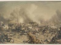
With the sesquicentennial of the Battle of Gettysburg quickly approaching, HSP has posted a lesson plan which discusses the Battle of Gettysburg, using primary sources from its own archives!
The lesson plan takes a slightly unconventional approach to studying and understanding the battle. Rather than a traditional lesson about the events, A Map Study of the Battle of Gettysburg uses two maps of the town, both ca. 1863, and its surrounding areas to understand how the battle unfolded and resulted in a Union victory because of the geography.
Created during the battle, the first map used in conjunction with this lesson plan was created by topographical engineer and Aide-de-Camp for General John Fulton Reynolds, Captain William Willcox, while the second was created in the wake of the battle, by northern map maker, Theodore Ditterline. Both rich in detail, the maps accurately record troop positions, locations of landmarks and account for the diverse topography of the town for a full understanding of the battle situation from July 1 - 3.
Students will be called upon to interact and engage with the maps by teaching their fellow students how geography plays into military strategy, using the Battle of Gettysburg as a springboard. With the maps as a foundation, students will also teach their peers the events during the Battle of Gettysburg, explaining how the geography of the battlefield determined much of the outcome.
This blog was written by a HSP Education Intern, Anthony DiAngelo, who also authored the unit plan.

